In the 1990s, China’s Yellow River began to dry up, and in 1997 it failed to reach the sea for several months.
In an effort to address the problem, government officials launched a scheme to protect the river’s source, a region about the size of Illinois called Sanjiangyuan (“Three River Source”) in northwest Qinghai province, which is also home to the sources of the Yangtze and Mekong rivers. The Sanjiangyuan National Nature Reserve was established in 2000. Since then, Ngoring Lake, the largest of the lakes in the Reserve, has seen its water levels rising and is now larger than its historical average.
Local officials claim this is proof that the government’s environmental preservation efforts have been successful, but recent research by climate scientists suggests a more worrying explanation for rising water levels: not only is climate change thought to be responsible for increased rainfall and snowfall in the area, it has also caused, by some estimates, up to a fifth of the permafrost which covers 80% of the plateau to melt.
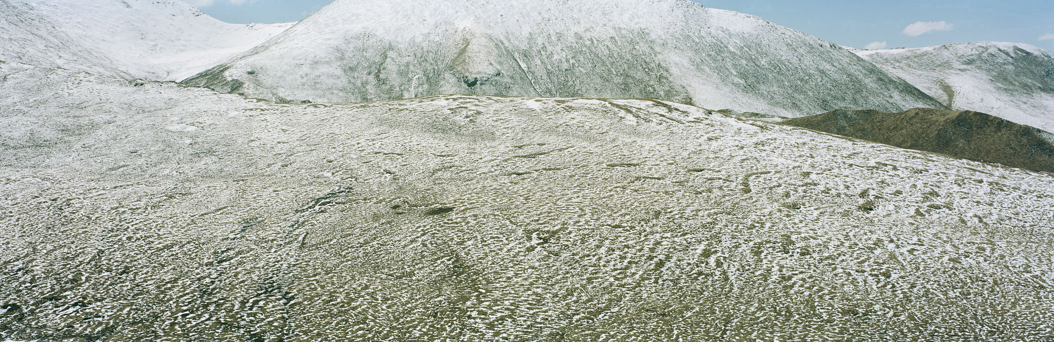
Mountain Range. Anemaqen, Qinghai, China. 2014
The Tibetan plateau stretches north from the foot of the Himalaya Mountain Range. Even so, the plateau has an average elevation of more than 5,000 meters. Scientists call it “the third pole” because of its influence on the earth’s climate. This land mass rising high into the earth’s atmosphere, governs the Asian weather system, with its lakes, glaciers, and wetlands acting as a huge water tower. Millions of people get their water from the great rivers—the Yellow, the Yangtze, and the Mekong—that are linked to the plateau.
Over the past forty years, the plateau has been warming much faster than the rest of the world, at a rate of 0.5 degrees Fahrenheit per decade. The glaciers of the Himalayas are melting at an accelerating rate and the permafrost across the plateau continues to warm. These problems are not China’s alone, as internationally shared water basins intensify the already strained hydropolitics of the region.
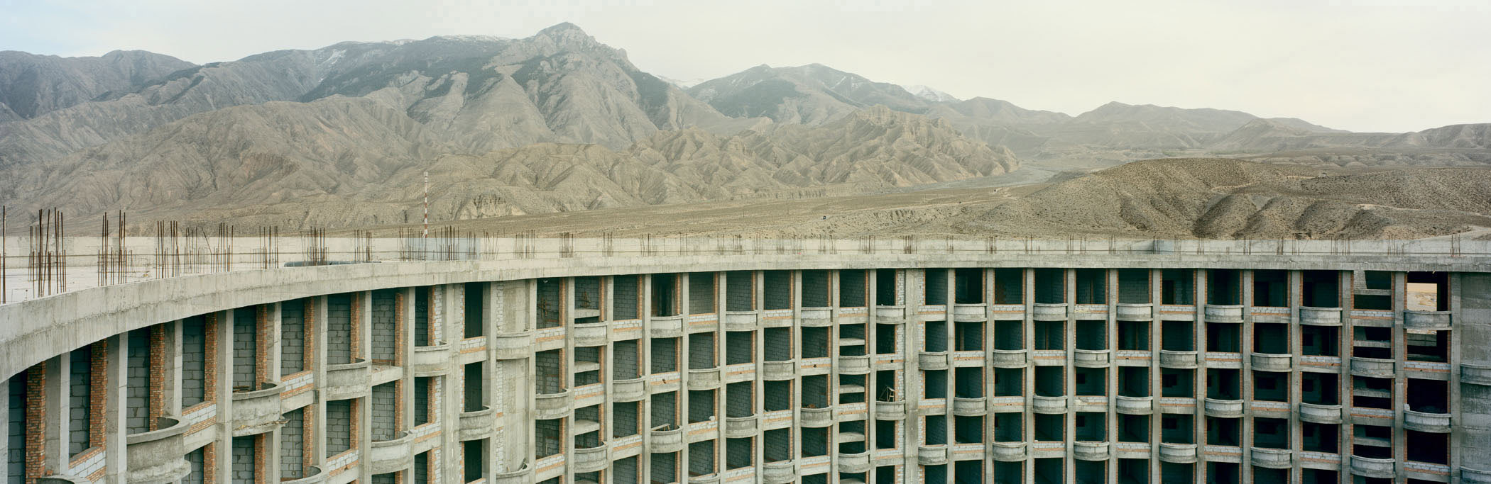
Abandoned 5 Star Hotel Construction. Guide, Qinghai, China. 2014
One of the benefits of creating the Sanjiangyuan National Nature Reserve, according to China’s State Council, would be “ecological protection and construction” on the plateau. Development in the protected ecosystem of the Reserve soon extended beyond tourism, to the mining of gold and other minerals just beyond its borders, road construction, and real estate development.
Meanwhile some of the tourism-related projects were lost to changing political winds: according to a local security guard, construction on this 5-star hotel came to a halt when developers couldn’t secure the necessary permits after a turnover in local government personnel. While much new construction in the area has reached completion, scientists have raised concerns that large towns and cities, and the infrastructure that connects them create higher densities of humans that will inevitably increase the stress on the local ecology.
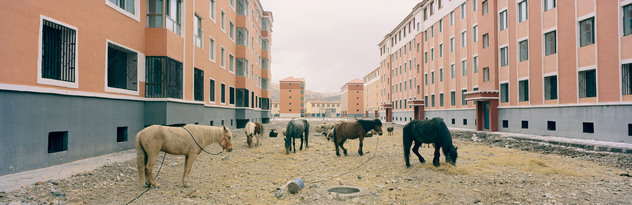
Tibetan Resettlement. Golog Tibetan Autonomous Prefecture, Qinghai, China. 2014
One controversial aspect of the Chinese government’s stated efforts to address ecological degradation on the plateau is the resettlement of Tibetan nomads into “new socialist villages,” what officials call “comfortable housing.” The creation of the Sanjiangyuan National Nature Reserve dramatically altered the livelihoods of millions of people.
In 2003, the Chinese government implemented the program tuimu huancao, meaning “retire livestock and restore grassland.” Since 2006, as many as 2 million people have been relocated in an effort to restore area grasslands and forests, a process the government calls “environmental migration.” This required some 300,000 Tibetan nomadic herders to give up their livestock in exchange for government housing and an annual stipend.
Today, the vast majority of these nomads have lost their traditional lifestyle and many struggle to find jobs and acclimate to their new conditions. Tuimu huancao was introduced more than a decade ago in the name of environmental protection, but since then studies show that the government relocation efforts have more to do with economic policy directions than restoration or protection of the delicate ecosystem.
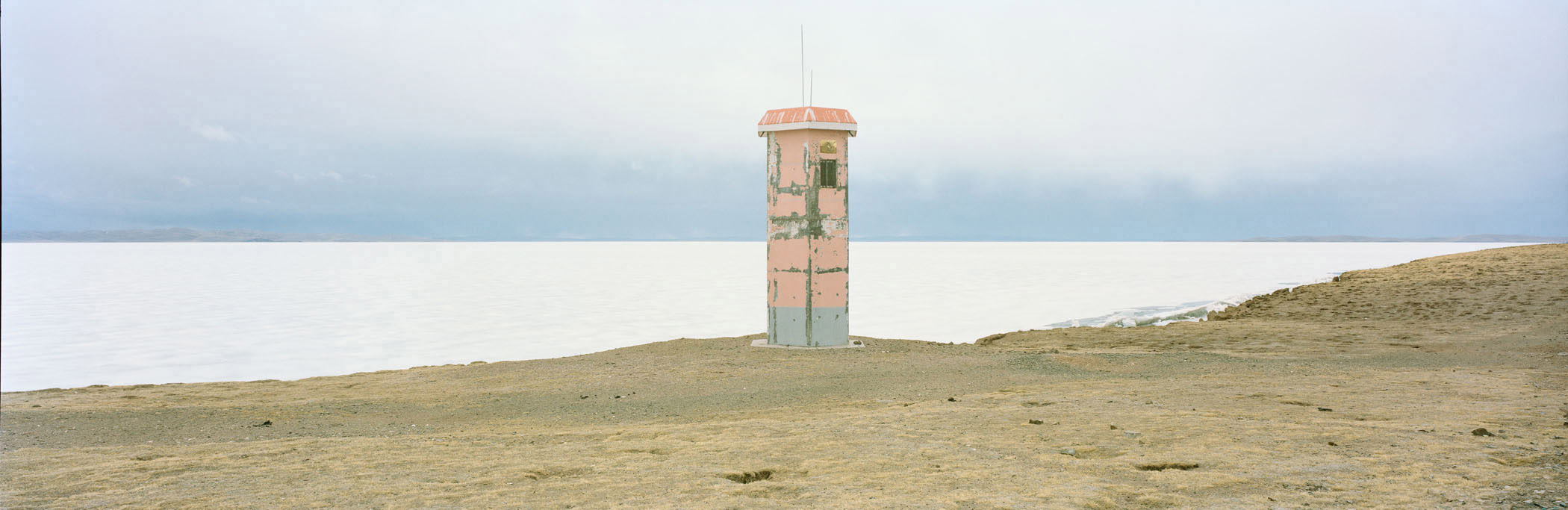
Viewing Outpost. Sanjiangyuan National Nature Reserve, Qinghai, China. 2014
A viewing tower on the frozen banks of Ngoring Lake rises above China’s highest wetlands ecosystem, located in the Sanjiangyuan National Nature Reserve. The lakes, glaciers, and vast underground springs of the Tibetan plateau—often called China’s “water tower”—supply nearly 50 percent of the Yellow River’s volume. But the warmer climate is sending the delicate ecosystem into shock. According to the Chinese weather bureau, temperatures in the region may rise by as much as five degrees Celsius by the end of the century.
Melting ice may add water to the river in the short term, but in the long-term the various manifestations of climate change could result in more dry spells. In recent years, the waters of Ngoring Lake, the largest lake in the region, have risen to levels higher than their historical average. The lake’s growth may be due to the melting of permafrost, which in the short term can lead to more surface water, but in the long term could accelerate desertification and cause the release of enormous quantities of methane gas.
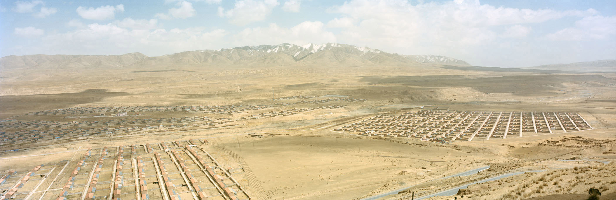
New residential development. Guide, Qinghai, China. 2014
Approximately 300 miles northeast of Ngoring Lake, an as-yet uninhabited residential development rises from the plateau. In between the buildings grass has begun to regrow and resettled Tibetan nomads let their herds graze these small patches.
The resettlement of a once nomadic people has compressed the space humans and animals occupy on the plateau. Studies have shown that the plateau and its delicate ecology are better equipped to withstand human populations that are spread out rather than concentrated into high density conurbation areas like towns and cities.
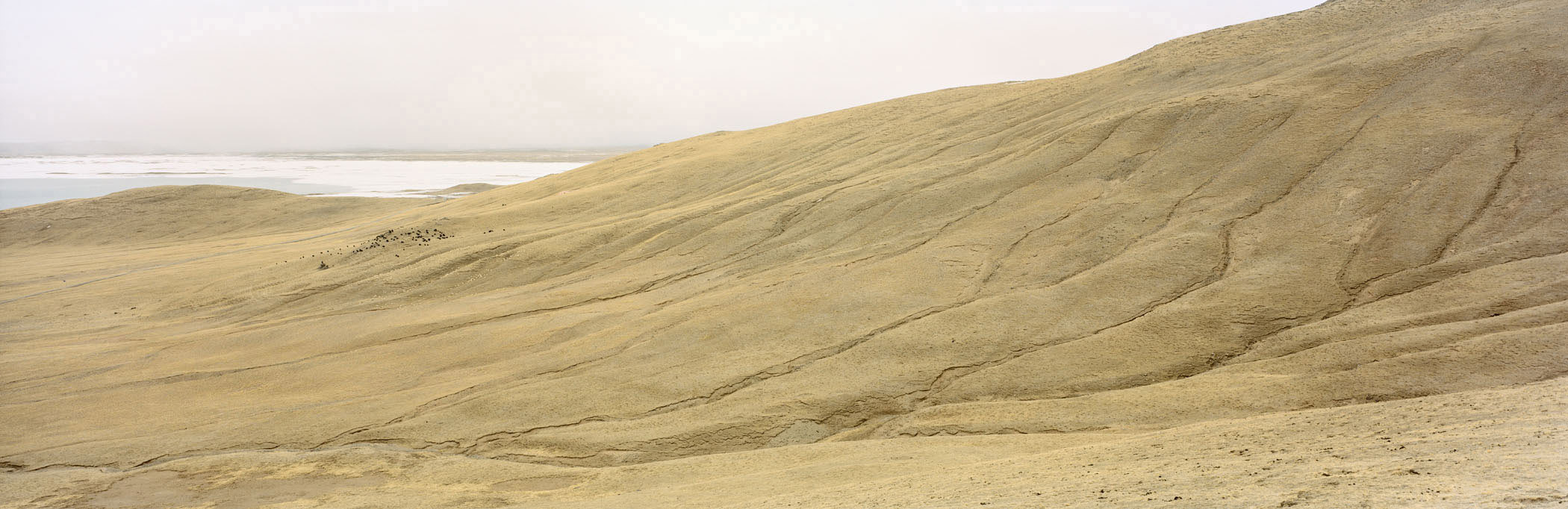
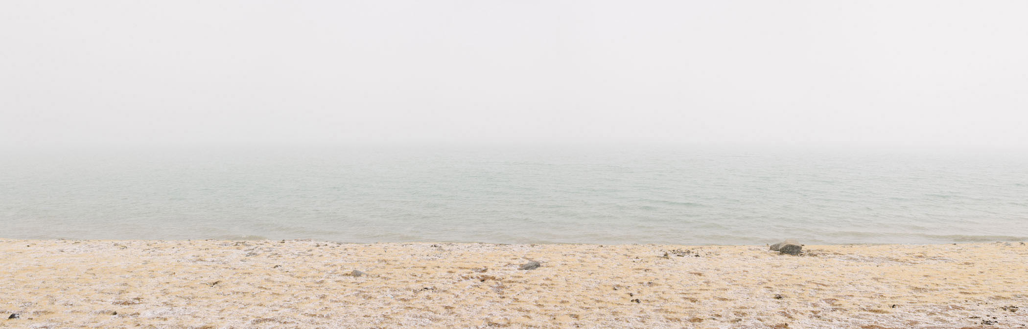
Grazing Yaks. Gyaring Lake, Qinghai, China. 2014
Here on the plateau, at the source of the Yellow, Yangtze, and Mekong Rivers, changes in climate occur at a faster rate than almost anywhere on earth, save the North and South Poles. For millennia this ecosystem has provided water for life downstream, moderated droughts and floods. Now Beijing relies on cloud seeding to increase rainfall in the region.
In Qinghai’s Madoi country which borders Ngoring Lake on its eastern shore, some 200 lakes measuring larger than six hectares disappeared between 1990 and 2000. Desertification has claimed wetlands, grasslands and smaller lakes. The region’s glaciers, meanwhile, are shrinking at a rate of 7 percent a year. Melting ice may add water to the river in the short term, but scientists say its long-term consequences, particularly for the Yellow River, could be fatal.
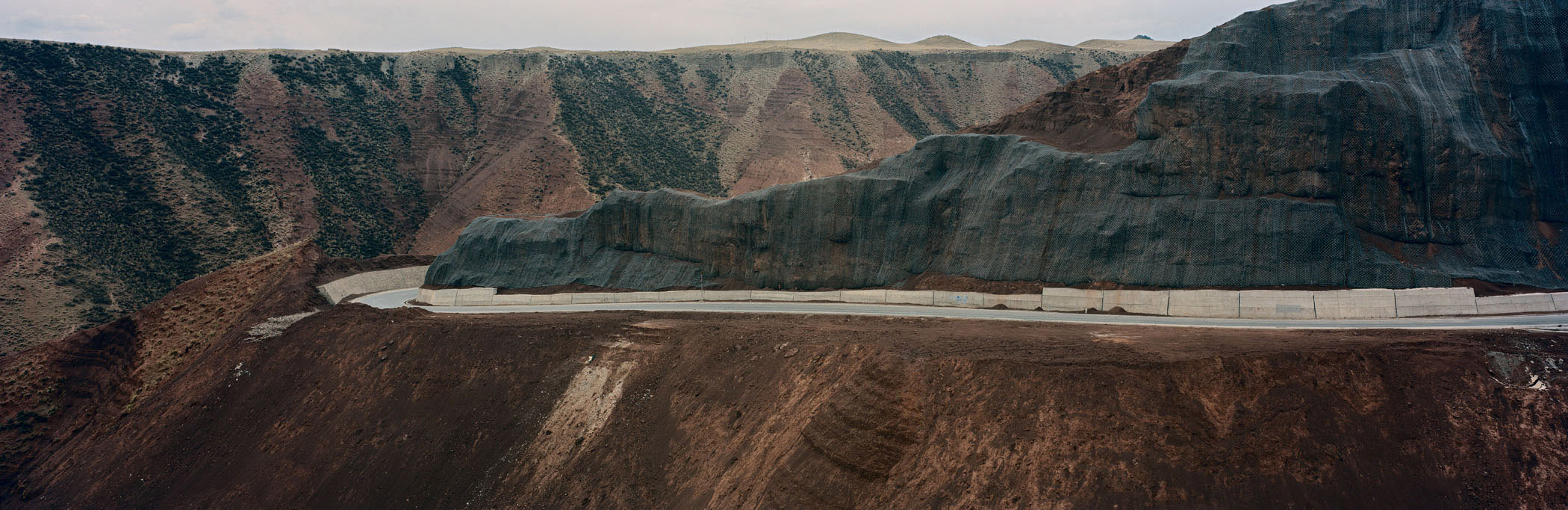
Road Construction. Golog Tibetan Autonomous Prefecture, Qinghai, China. 2014
In 2000, the Chinese government recognized that an environmental crisis was underway and created the Sanjiangyuan National Nature Reserve, stretching for more than 140 square miles over China’s Tibetan plateau. In recent decades, as China’s cities and economy have grown rapidly, the plateau has been increasingly explored for resource extraction.
A single mine, the Muli mine, contains 3.5 billion tons of coal, or 87 percent of the province’s reserves. The infrastructure necessary to move supplies and resources has further altered the landscape as road construction projects cut through the plateau, and open mining pits abut protected wilderness areas. Environmental groups say that these projects harm the wildlife and delicate ecosystem the reserve was created to protect.
Farmland. Guide, Qinghai, China. 2014
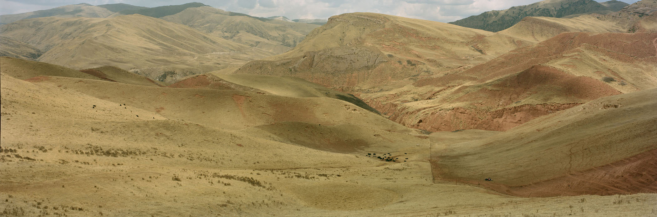
In the 1970s the communal system of open pastoral grazing that had existed for centuries on the Tibetan plateau began to change. Grasslands began to deteriorate. Around the same time, economic reforms led to the privatization of formerly communal lands. Fencing altered the grazing patterns herders had used to move their livestock over the fragile landscape. Confined to smaller areas, the animals overgrazed, further damaging the grasslands.
The grasslands face a variety of threats, according to a study published by the U.S. Department of Agriculture in 2006. They include a drier climate, population growth among both humans, and pika, burrowing mammals related to the rabbit whose predators have been over-hunted, livestock concentration near winter settlements, reduced mobility for herders due to restrictive land tenure, and lack of government investment in rangeland and livestock marketing. The study’s authors note that all but the first of these factors, are related to government policy.
Here on the plateau, at the source of the Yellow, Yangtze, and Mekong Rivers, changes in climate occur at a faster rate than almost anywhere on earth, save the North and South Poles. For millennia this ecosystem has provided water for life downstream, moderated droughts and floods. Now Beijing relies on cloud seeding to increase rainfall in the region.
In Qinghai’s Madoi country which borders Ngoring Lake on its eastern shore, some 200 lakes measuring larger than six hectares disappeared between 1990 and 2000. Desertification has claimed wetlands, grasslands and smaller lakes. The region’s glaciers, meanwhile, are shrinking at a rate of 7 percent a year. Melting ice may add water to the river in the short term, but scientists say its long-term consequences, particularly for the Yellow River, could be fatal.